Article by Loic Van Audenhaege and Tabitha Pearman, NOC
Tabitha Pearman and Loic Van Audenhaege (both at National Oceanography Centre, UK) were very fortunate to attend the GEOHAB 2023 conference (Marine Geological and Biological Habitat Mapping) gathering experts in marine geology and ecology working on coastal and deep-sea environments all over the world. Their participation was made possible by the generous funding provided by Veerle Huvenne (NOC) and iAtlantic. The conference took place in La Recif hotel in Saint-Gilles-Les-Bains, La Réunion island (Indian Ocean) from May 8 to 12th 2023 (Figure 1A).
The first day started with a workshop on photogrammetry. Photogrammetry involves the collection of 2D images used by very specific algorithms to recreate a 3D scene in a virtual environment from which metric descriptors can be retrieved. As the community of photogrammetry users has been growing for the past decade, that workshop aimed to providing the attendees the confidence and some basic concepts to start their own photogrammetric investigation. Loic Van Audenhaege co-organised the workshop with David Price (University of the Azores, Portugal), Isabel Urbina-Barreto (Institute for Research and Development, France), Vincent Mahamadaly (CREOCEAN, France) and Alexandre Sneessens (CREOCEAN, France), who presented on the basic aspects of photogrammetry, imagery collection and case studies (Figure 1B-C). The workshop focussed on three modes of photogrammetry acquisition: aerial (e.g., drones), shallow water (e.g., by scuba diving) and deep-sea (e.g., with remotely operated vehicles) with the aim of connecting an often-disconnected community, despite similar research goals. For this reason, GEOHAB offered the best platform for running that workshop because of the diversity of scientific backgrounds represented by attendees. On top of that, Loic got the chance to run a 3-hour hands-on session during which he asked the attendees to acquire their own image set (also with a small ROV in the hotel swimming pool). The participants were then guided through the different steps of processing and analyses of a 3D model (Figure 1D).
Figure 1 - (A) Entrance of La Recif hotel that hosted the GeoHab conference, (B) Loic Van Audenhaege giving an overview of photogrammetry principles during the GeoHab workshop, (C) The workshop organising committee: (from left to right) Loic Van Audenhaege, Vincent Mahamadaly, Isabel Urbina-Barreto, Alexandre Sneessens, David Price, and the GeoHab organisers Rodolphe Devillers and Hayley Cawthra (not in picture), (D) 3D model of a scene made of sand and coral fragments acquired with 35 pictures by the participants.
The day closed with the icebreaker, a good opportunity to get feedback from participants. Feedback was positive, with participants feeling more confident with photogrammetry and one participant even launched a photogrammetry reconstruction on his own data the evening after the workshop which he then presented at the main conference! Quite rewarding! The material from the workshop will be available online for anyone wanting to rewatch and learn the basics of photogrammetry. (DOI: 10.5281/zenodo.7934452).
Tuesday, Wednesday, and Thursday were dedicated to scientific talks and posters (abstracts available via 10.5281/zenodo.7890332). Tabitha and Loic got the chance to attend various presentations from predictive mapping of habitat and biological communities, including new perspective on hierarchal species distribution modelling to novel methods to acquire data and detect processes in the underwater realm (e.g., eDNA, deep learning). Tabitha presented her work entitled “Resolution of Vulnerable Marine Ecosystem maps of the SW Atlantic deep sea – what do we miss if we cannot use shipborne bathymetry data and what are the consequences for Marine Spatial Planning?” as part of her postdoc in the Falkland Islands. Loic presented his work entitled “Photogrammetry temporal monitoring in the deep sea reveals the fine-scale variability in hydrothermal vent assemblages” as part of his PhD funded by the iAtlantic project.
Figure 2 – Tabitha Pearman presenting her work on VMEs of the SW Atlantic deep sea.
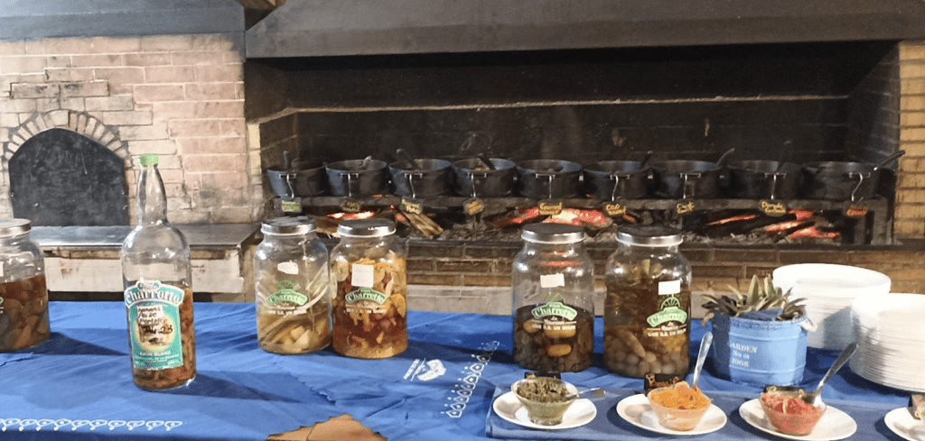
The last day was dedicated to a field trip around the southern side of the island, an important excursion as ~40 % of La Réunion has been listed as a World Heritage Site by UNESCO. As the mist rises very early on the heights of the island, the bus started at 5am for a 2-hour journey. Luckily enough, we were able to get a breathtaking stop at a number of vistas as we rose to the active volcano Piton de la Fournaise in the southeast of the island that reaches an altitude of 2,632 m (Figure 3B). The Piton de la Fournaise is one of the most active volcanos around the World, with several eruptions and lava flows that occurred for the century. Despite the strong sun, we got the chance to stop in the Plaine des Sables, an outstanding Martian-looking landscape made of rocky outcrop emerging from a large spread of red sand harbouring very limited vegetation (Figure 3C). Throughout the day two very informative guides presented a geological history of the area and we spent the afternoon on the geological museum. Last but not least, we usually finished our days with grabbing a ‘carry’, a famous Creole dish, to replenish our stomach after a long day of conference (Figure 4).
Overall, this conference was a great success that allowed us to meet a wide diversity of people working in different ecosystems other than the deep sea. It was a very helpful conference to target future collaborations and to keep track of the evolution of the mapping field of research.
Figure 3 - (A) The Cilaos cirque, (B) The Piton de la Fournaise in the background and the Formica Leo in the foreground, (C) The Plaine des Sables.
Figure 4 – Typical open-buffet of ‘marmites’ of carry, heated on a woodfire in the background chimney (rougaille saucisse, chicken vanilla, rooster or octopus with wine, dorado with ginger served on top of rice), mixes of rhum in the foreground. Carry was an important detail contributing to the success of this conference, by gathering people altogether at the table.