Day 3: Tuesday 23 June 2020
Our first day of transit is quite busy with planning meetings, clearing-ups of already emerging jumble, and doing a safety drill to practice the worst-case scenario. As of yet there is not that much science going so I will take the opportunity to introduce some of our research group leaders!
 Saskia Brix is our chief scientist and she works as a biologist at Senckenberg am Meer in Wilhelmshaven, Germany. She’s got the hat on for our cruise. Everything related to station planning, organising and decision making goes through her. She’s been planning this cruise since 2013 (at that time, the new R/V Sonne wasn’t even existing!), and it has been her heartfelt wish for it to happen ever since. Originally, the cruise should have taken place 3 years ago but it has been delayed several times. Then along came Coronavirus… but finally we’re all here now thanks to Saskia’s tireless and insistent efforts! Among marine animals, seahorses are her favourite animals, but she works with a completely different group: deep-sea crustaceans. Although the adventures with ROV Kiel 6000 were her dream for this expedition, in general her favourite device is the brand-new epibenthos sledge (EBS) called ‘Ursula’ that was ceremonially baptised yesterday. With this, she can devote to her most beloved field of research, the isopods (small crustaceans). Saskia has over 10 years’ experience in leading and participating in cruises, and she can tell many stories about life at sea. Here is one of them: It was on a cruise to the Neumayer station in the Antarctic, during a cold and ice-heavy antarctic summer, when they met a freighter that was stuck in the ice. It had to be freed from the ice, and soon it was discovered that the freighter had been running out of fresh water for days. So its entire crew ended up entering RV Polarstern to take their long overdue showers…
 James Taylor is the group leader of the scientific ROV team. He is working as a biologist at Senckenberg am Meer in Wilhelmshaven and polar bears are his favourite animals. When he’s not at work, you can find him on one of the upper decks, nose in the wind. His major focus during the ROV operations on board is the video footage, offering the opportunity to see – in real time – what is happening on the seafloor and being able to get highly specific ground-truth data using non-invasive methods that do not harm deep-sea life. One of the most exciting adventures in James’ career was when he was invited to Cambridge to catalogue and reclassify samples of barnacles that were actually been collected by Charles Darwin himself! Apparently, Darwin had really bad handwriting!
 Morgane Le Saout (GEOMAR-Helmholtz Institute for Ocean Research) leads the hydroacoustic group and organises the multibeam surveys in order to get high resolution maps of the seafloor. Knowing the topography of the ocean’s bottom in detail is the basis for any successful operations as a lot of information can be derived from bathymetry, such as sediment characteristics, slopes, under water features and many more. Morgane’s craziest experience related to science was a shark attack during a magnetometer dive – it probably considered the magnetometer to be something to eat because next to the bite marks, Morgane found a shark tooth sticking out of the plastic case!
Day 2: Monday 22 June 2020
Things are starting to become serious on the second day. It’s time to hit the road…uhhh no – to set sail and head off for Iceland! After settling and unpacking each single box containing lab equipment such as chemicals, microscopes, small bottles, large bottles, medium bottles, tools and a lot more, R/V Sonne is released from the ropes that are tying her to the pier. Hooting solemnly to say good-bye to R/V Maria S. Merian (one of the other German research vessels), who is lying alongside to us, R/V Sonne starts her engines to cast off. But before going anywhere we need to pass the lock that keeps the (very) low tide on the mudflats out of the harbour area and ensures the under-keel clearance. I can tell you, it is quite fascinating to see such a large vessel entering such a small gap and still being overtaken by other ships – the captain certainly knows what he is doing.

We leave the lock safely and now the open ocean is waiting for us. Our journey continues and passing huge wind parks, we go north, north, north… On the way up we will cross the exclusive economic zones (EEZ) of three countries: the Netherlands, Denmark and Norway. EEZs are those areas of the ocean that (except for some special cases) extend to 200 nm beyond the land-water-mark. According to the United Nations Convention on the Law of the Sea (UNCLOS), each country has sovereign rights in ‘their’ EEZ, meaning that no scientific operations (and no fishing, drilling etc.) is allowed to take place without permission. Thus, any research work and all its details have to be announced, depending on the country, up to 6 months in advance and approval has to be granted. Bearing this in mind and considering the Corona situation, it hasn’t been possible to apply on time for research permission in every country’s EEZ that is being passaged. Hence, there is some transit time which is very well used to get organised and plan the actions for station 1, located north-west of the Faeroe islands in the Norwegian basin. It’s just a tiny little bit south of the polar circle (65° N, 0° E)! But more on this tomorrow!

Day 1: Sunday 21 June 2020
Welcome to the IceAGE3 blog on the MerMet 17-6 cruise on R/V Sonne!
Having completed a 3-day quarantine in the hotel room with lovely service and loads of delicious meals, everyone got a negative result for the Corona test – meaning that all of us (ship’s crew, ROV team and science group) were free to board R/V Sonne for a 5-week cruise around Iceland.
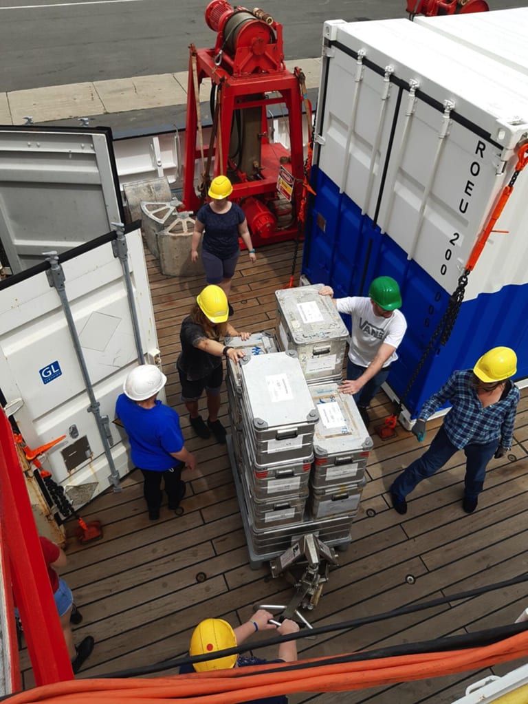
Once arriving aboard, we were shown the (single!) cabins and after a short lunch break we started unpacking the containers. Such a large amount of equipment! There is the benthic sledge which is being dragged over the seafloor trying to collect representative samples of the seafloor. There is the box corer and the MUC (mulitcore), both giving us the chance to sample seafloor at distinct points to know precisely where the probe is from. Last (but certainly not least!) comes the plankton net that sweeps through the water column collecting the smallest, yet one of the most important, species in the marine food chain. For nearly every observation or measurement being made in (ocean) waters it is crucial to know three basic parameters: salinity (i.e. conductivity), temperature, and the pressure (depth) at which those measures are taken (and of course position and time, because of seasonal and temporal variations of the measures). The instrument that provides us with those important values is called a ‘CTD’ and basically consists of a steel construction holding bottles which can be opened (and closed) at certain depths to sample sea water. By knowing salinity, temperature and depth, the local sound velocity can be derived. This is, among others, essential to consider for bathymetry mapping, i.e. acoustically strobing the seafloor to get an idea about the topography. Mapping is done with a multibeam echosounder that is installed on the hull of the vessel. It operates by transmitting acoustic energy waves through the water column. They are reflected by the ocean floor and from the time the signal needs to travel back to the echosounder, the water depth can be calculated. Using the strength (intensity) of the reflected signal gives information about seafloor characteristics. Having a high-resolution map is the basis to all further operations as, to mention only one reason, we don’t want to crash the expensive equipment into a seamount (or destroy that seamount, either!).
And now, a spoiler for what is coming up in the next days/weeks: Probably the most exciting instrument on board R/V Sonne, ‘Kiel 6000’, is waiting on the quarterdeck for its launch…stay tuned if you’d like to meet him and get insights to real deep-sea science! More on this will follow!